The almost empty lanes of Sullana
It costed US$ 187,500 but its users prefer going to Chira Valley.
By Nelson
Peñaherrera Castillo


The sunset between Districts Marcavelica (first) and Salitral (second) as one of our producers took while he was running along Chira Valley. (Photo by Luis Correa / FACTORTIERRA)
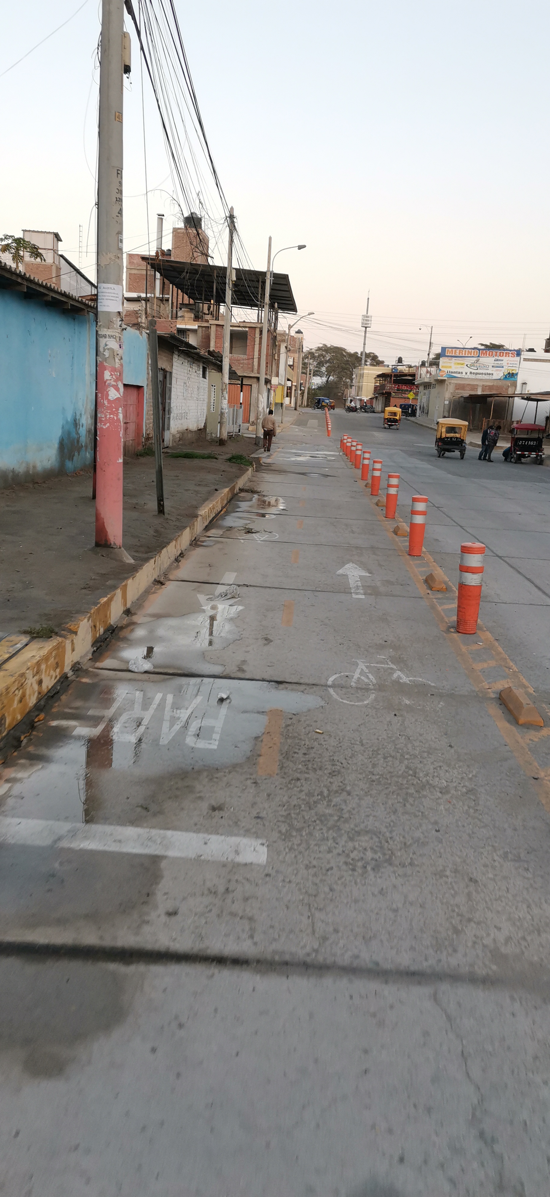
SULLANA, Peru – The papers say bikeway. For real, it
may be called free community car parking. In Santa Rosa Urbanization, West Sullana City, some neighbors use the lane for bikers like a parking for their
cars, pick-ups, or motorcycles – it apparently has not been hard to get it.
The cement of conntention
bumps has pulverized quite easily – there aren’t today, already. Add to this,
the paint marking the signs from, on, and toward the bikeway is practically
vanished.

.jpg)
.jpg)
Damaged accessories of the bikeway in West Sullana City and the use the neighbors really give it. (Photos by Luis Enrique Curay, especial to Semana and distributedd by FACTORTIERRA)
Initially, the work costed
around US$ 143,000 invested by Peru’s Ministry of Transport and Communications, purposed to promote sports, to care
environment, and to prevent contagions from Covid-19 in
urban transportation… or that said the press release published on December 2nd,
2020.
Its building started
beginning 2022 and US$ 44,500 were added to the budget, according to the
mandatory sign. Critics came because of the amount and the difficulty of work.
The most recurrent one was it made the road narrower for engine vehicles.
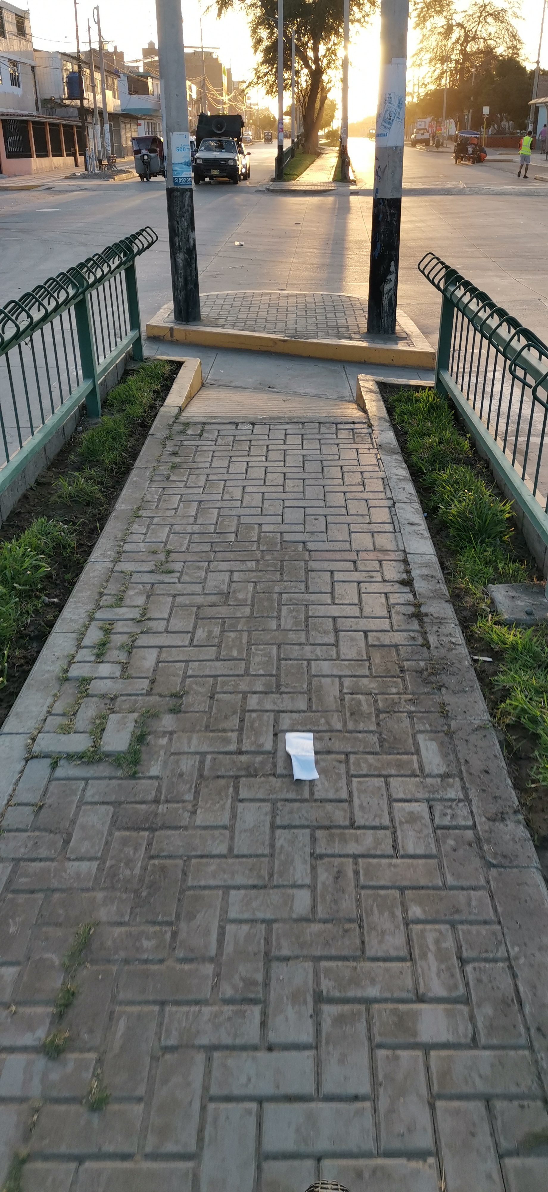
Let’s run along the bikeway of Sullana City and its condition updated on June 28th, 2022 (All photos by Luis Enrique Curay, special to
Semana and distributed by FACTORTIERRA).


.jpg)


Santa Cruz Avenue, south side of the city.


Champagnat Avenue, between Sullana Downtown and West Sullana City.


Bolognesi Square, West Sullana City.
.jpg)


Around Santa Ursula School, West Sullana City.

Jose de Lama avenue, Sullana Downtown
Pedaling in a labyrinth
In practical terms, the
bikeway goes up and down around Sullana Downtown for 4.5 miles. Then, branches without apparent connection appear.
One pass near La Selva (The Jungle), a bourgh tagged as very dangerous,
especially in the bridge over Cieneguillo Creek that divides Sullana Metro Area in two halves. It’s 1.5 miles additional to the count.
“I don’t know if any biker
wishes to pass through there at eight in the evening,” the physical trainer and
community activist Luis Enrique Curay criticizes, “unless you go in doing biking, then go out doing
speed jogging.” In english: it’s probable somebody steals your bike.
At Parqé de los Leonés (Lions
Park), just between Sullana Downtown and West sullana City, the bikeway is
interrupted forcing the biker to carry up the vehicle on the shoulder. It’s a
good exercise for biceps but it’s not supposed this is the idea.
The real routes the bikers of
Sullana use to work out (All
photos by Luis Enrique Curay, special to Semana and distributed by
FACTORTIERRA).


Las Palmeras Circuit (Marcavelica District).
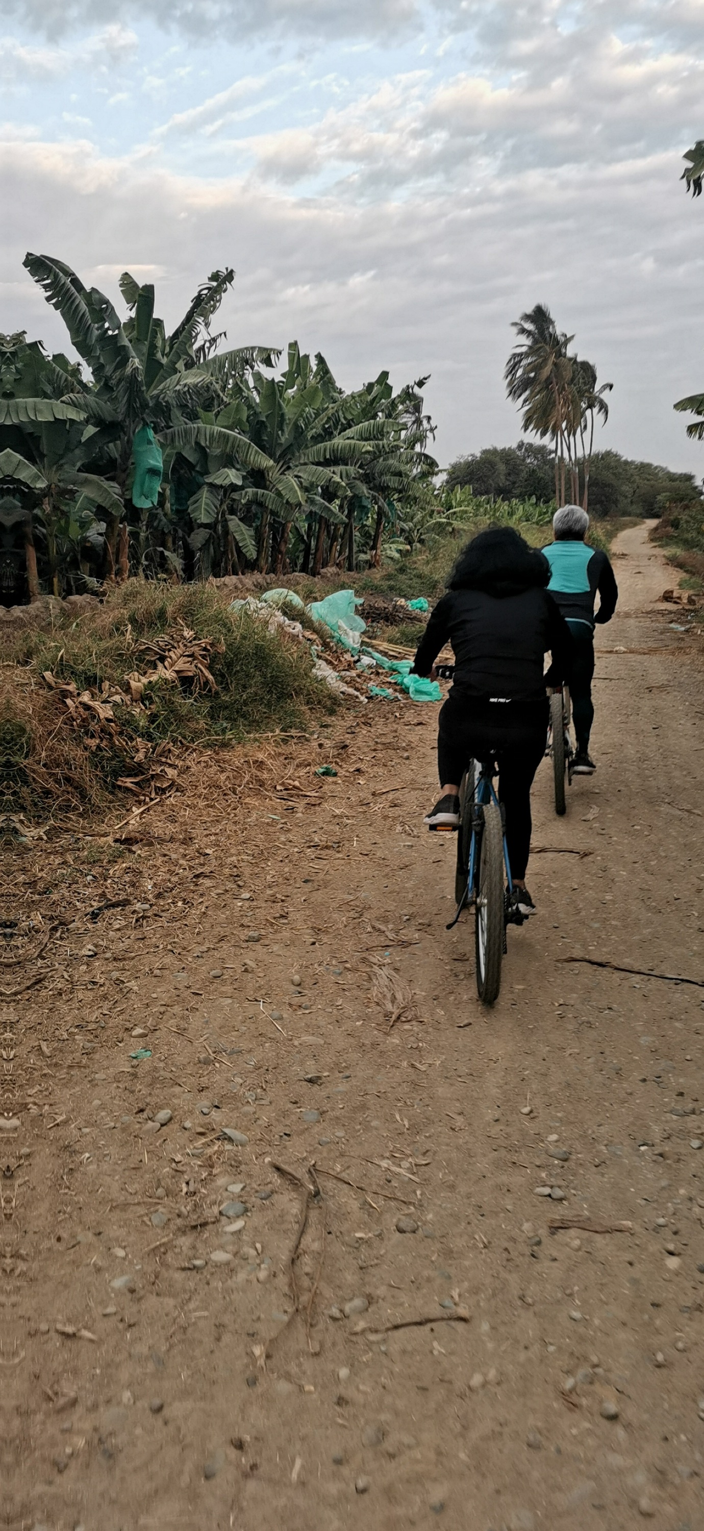
Cruising Chira
Most bikers work out across
the valley, in Marcavelica, at a circuit that was traditionally dedicated to
cycling. It begins in the emigmatic Nariz del Diablo (debil’s Nose) Hill, 5
miles away Sullana Downtown, and it continues toward Las Palmeras (The Palms).
At least, it’s one mile of clay soil.
“we use it there because we
are away the cars and trucks going on the road,” explains Mario Arias Mena,
companies manager who has been dedicated to competition biking since he was a
high-school student. Inclusive, the circuit extends to La Noria (The Fair Ferris wheel), a village of
Marcavelica, 27 miles away Sullana Downtown, almost the same distance from this
point to Piura Downtown.
Mr Arias adds they use
another one amid the hills of Querecotillo District, located somewhere at 11 miles to the northwest of Sullana
Downtown. And what about the bikeway in Metro Area? “It’s useless for us,” he
stresses.
The amazing postcards some
bikers and runners get when they trail along Chira Valley (All photos by Luis Enrique Curay, special to
Semana and distributed by FACTORTIERRA).


A path beside Chira River, Marcavelica District.
Urban threat
Bikers are not the only ones
who benefit from this circuit they use between Marcavelica and Querecotillo –
runners trail the paths, trekkers hike amid the hills. The evergreen view of Chira Valley, the
abundant river, and the skyline of Sullana are worthy, they say.
And just for the record,
Turicarami Boulevard, at the Chira bank running through Sullana City, is a kind
of huge outdoor gym – almost 3300 feet length, a 100-feet-height stair, viewing
the valley.
The problem they fase is that
the urbanization today could leave them without natural spaces for working out.
Nariz del Diablo, where it’s supposed the Tallans worshipped
a golden alligator, suffers from predation a couple of years ago. Houses are
already getting to it. Let’s add the trash left by exportation banana agriculture, and some lovers who dare to use the site for having duty-free sex.
Similar happens in Las
Palmeras where the old cycling lane almost has been deleted from the map by the
houses, when it was able for camping or organizing sport competitions until
mid-1990s.
Meanwhile, the bikeway of
Sullana bothers the drivers and some pedestrians as well as business owners
along its trail, especially when an accident happens, something that has turned
frequent. “The people crowds, they don’t let the clients get into the stores,”
complains Angelo Azabache who today
manages a restaurant on Santa Rosa Avenue,near one of the lanes. Crash warns,
the block’s clown would say.
This version: © 2022
Asociación Civil Factor Tierra. All Rights Reserved. Comment this in the box
below or on our Facebook and Twitter accounts. Would you like to know the places
featured on this entry? Write us at factortierra@gmail.com


Comentarios
Publicar un comentario