Entradas

Se muestran las entradas que coinciden con la búsqueda de touristic route

The Sullana longest wall paint was made so

Imagen
    Photographs provided by Dandy Ruíz Estrada, distributed by FACTORTIERRA.   MARCAVELICA, Peru – Perhaps the most difference between an artist and somebody who’s not in it lays over his skill to see the beauty, or the possibility to make it up, right there where we see something usual or insignificant. That was why Dandy Ruíz Estrada , a.k.a. El Dandy, made as much as possible for the wall of a school turned a canvas of a collective creation.   “We’re losing the identity,” stresses the 40-year-old visual artist, Mallaritos-native, a town forming now one urban zone with Marcavelica, both part of Sullana Metro Area, the largest of Chira Valley .   At Andrés avelino Cáceres School, also known as Mallaritos, El Dandy and students of the three first high-school grades took over than 120 feet of wall –almost the front yard of 4 average houses in Sullana—and they started to represent frames of the local identity and ecology , as well as the histor...

Las Palmeras de Yaranche's Coppers

Imagen

On The Integration's Way

Imagen
The first bike ride play that celebrated  the signature of ecuador-Peru Peace Agreement. By Nelson Peñaherrera C . All photographs provided by Radio Nuevo Norte and distributed by FACTORTIERRA. The pictures belong to the first edition of bike ride play on September 19th, 1999, and this is the first time they are released than any website before. Km or Mile 0, Sullana City, Peru. Altitude: 60 m or 196 ft. The starting point since the first edition on September 19th, 1999. Km 25 or Mile 16, Valle de los Incas, near Tambogrande City, Peru. Altitude: 72 m or 236 ft. MACARÁ INTERNATIONAL BRIDGE, Borderline between Loja, ecuador and Piura, Peru - It is another day among several days when buses cross over Macará River , the flow that after running towards the West, meets Catamayo River and forms Chira River . Tourists, salespersons and people with mostly domestic agendas use the path regularily and much easily just presenting their national IDs, an Andean Card and perhaps a...

Between Morán Mount and Platillos

Imagen
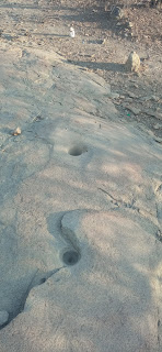
A trekking trail connecting at least three sites with archaeological evidence in Malingas.   Photographs gathered by Milton Garcia Navarro   TAMBOGRANDÉ, Peru – In 2011, FACTORTIERRA announced to the world the existence of an archaeological rests network that could be until 4000 years old, located at the central part of Malingas Community . Basically, it’s about evidences of art-on-the-rock on and around Malingas Cord, a branch formed by five mounts apparently caused by volcanic activity judging the basalt that mostly forms their slopes. More than a decade later, it’s starting to value the touristic potential the zone has, despite the sites have not officially confirmed yet, they just have a preliminary survey by the archaeologist Daniel Dávila Manrique , the first scientific explorer of the zone between 2010 and 2011. “I’d like to return, make a new survey of every site,” Dávila said to FACTORTIERRA, when he learned about the initiative of giving them a touristic...

Your weather monitor for Piura

Imagen
Time to travel? FACTORTIERRA delivers an automatic tool to do your own forecasts.     Why should you spend your next vacations in Piura Department , Peru? First of all, the diversity of landscapes from the sea level to the snowless Andes that will give you different choices, from adventure to extreme passing through experiential. And maybe the most interesting insight is the constant weather – temperatures as well as feelings use to be nice along the year, especially since April to December… unless you want to enjoy our summer since January to March.   However, before to book your trip, or if you are up to take the plane (or the bus), it’s necessary you learn what the weather conditions are for your chosen destination. That’s why in FACTORTIERRA, we have checked out not only the most popular touristic places but others we have highlighted with our tourism tag on this blog, or our #visitPiura hashtag on Twitter. So here we have them classified by eco-regions ...