Tambograndé-Chulucanas Road – The bridges never built
It’s a key axis joining agriculture and commerce, until summer rains become it impassable.
By Nelson Peñaherrera Castillo


Overload in San Francisco Creek, between Sectors Palominos and Malingas (Tambograndé District) during a rainy summer. (Photos by David Dominguez / El tambograndino Noticias / file).
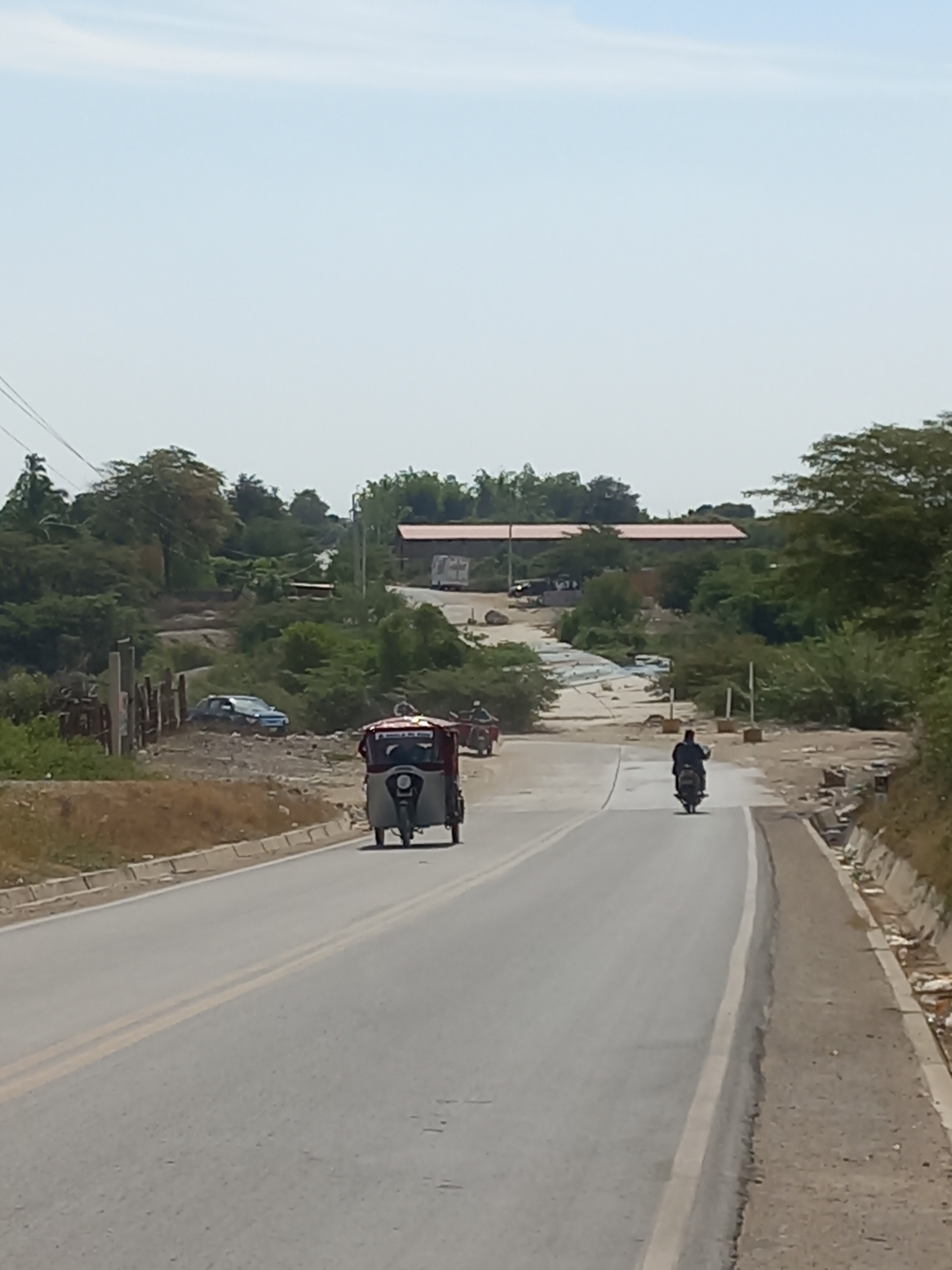
Tambograndé-Chulucanas Road is a show anytime through the year. The sky
can be white, gray, light blue sky with a burning Sun. But on the land,
dismissing the black asphalt, all green tones dance in a messy, tender
choreography.
Officially, the PI-107
way is 27 miles counted from óvalo del Campesino (Farmer’s Circus), Tambograndé
City (Piura Province), toOrozco Falla Park, Chulucanas City (Morropón
Province). Many applications calculate the trip takes about 50 minutes as
much, of course, if you go on your own transportation.
The rest of
mortals must be two transshipment at least. The first one in Malingas, 9 miles and 17 minutes tripping. The second
one in Pac-cha, 17 miles and 27 minutes trailing.
To have a
perspective, the distance between cities of Piura and Sullana is 24 miles and
the trip takes 31 minutes going on own transportation. If public service is taken,
it’s express with a little wait in the toll at the entrance to Curumúy.
The last is
explained because while it’s running hills up and down between Piura and Sullana,
the road between tambograndé and Chulucanas crosses six significant creeks at
least. Going from north to south: Carneros, Socárron, San Francisco, Sancor,
Sol-sol, and Yapatera [up from here, let’s see the actual status of each creek
as it is featured in this story].


Carneros Creek (Tambograndé District) runs just beside Tambograndé City, it’s the first huge obstacle when it overloads in rainy summers. The creek leads in Piura River, just one mile to the south from the spot this picture was taken. (Photo by Jonny Dioses, special to Semana and distributed by FACTORTIERRA)
And while the
Piura-Sullana has two pretty long bridges, there’s no one in the
Tambograndé-Chulucanas. Even, the Sullana-Tambograndé, that crosses a divertion
canal and two big creeks, owns such carways.
For local
leaders along Pi-107, bridges are not only needed for these six water flows but
five more for some drains that also interrupt the road. At the moment, there
are speed bumps, but when it rains pretty heavy, they are simply
useless.


Socarrón Creek forms this lovely swamp between La Pala and Las Monicas (Tambograndé District) from fall to spring, but if it rains the next summer, this little bridge is going to be drowned by the torrential water. (Photos by Jonny Dioses, special to Semana and distributed by FACTORTIERRA).


Next, San Francisco Creek, that becomes a huge, wide river when it rains in summer (see the first two pictures beginning this entry), where local leaders have been claiming a bridge for 40 years around. (Photos by Jonny Dioses, special to Semana and distributed by FACTORTIERRA).
Strategic route
Going from Tambograndé to
Chulucanas in months of fall and spring, between mid-April to all December in
other words, it’s bearing until some point. The fact that the half of the way
crosses the southeastern section of San Lorenzo Colonization makes it safe because, just in emergency case, there’s ever a nearby
town: La Pala, Las Monicas, Cruce de Vega, Malingas, San Francisco de Pac-cha,
Pac-cha, sol-Sol, and Yapatera.
Its asphalt since 2010
energized it much more. Little and big growers of mango, lime, passion fruit,
and the almost just coming of table grapes use it along the year to go out to
local or national markets like Lima or Peruvian Jungle, and international
through Paita via the North Inter-oceanic.
FACTORTIERRA: How much mango is important for exportation.
From a geo-politic
perspective, the Tambograndé-Chulucanas Road is quite strategic that allows
going straight from Ecuadorian Andes to Peruvian Jungle not needing to pass
through Piura City. In fact, according to the Peace Agreement both nations
signed in October 1998, this is the Vial Axis 3, although it originally ended
in Sullana City.
FACTORTIERRA: How a Sullana-based radio station used the Vial Axis 3 for making
an integration caravan.


CP8 Drain (Tambogrande District) forms this kind of canal that could be pretty funny when the season is dry, but what could turn a headache when heavy rains become a peaceful residual spring like another violent creek. (Photos by Jonny Dioses, special to Semana and distributed by FACTORTIERRA).
Only promises
When the summer is rainy,
especially in March, everybody suffers from isolation because the creeks pass
from having lazy flows and depths to torrential, violent rivers. Sol-Sol
(Chulucanas District) is one of the most feared – many people died trying to
wade it [see the photos down this story].
But, no doubt, the major one
is San Francisco,
between sectors Palominos and Malingas (Tambograndé District). While it
survives during fall to spring from drainage from acres in both banks, it can
overload in summer rim to rim. It’s quietly 990 feet width, until 10 feet
Depth.
A speed bump existing
in the half of its course was razed by 1998 El Niño and its rests are still
possible to see in the middle. The actual one remains firm, full of moss, and
it has resisted overloads in 2001, 2012, 2017, and 2021.


Pac-cha Drain (Chulucanas District) takes residual water from acres around, but it turn another violent creek when it rains heavy every summer isolating Pac-cha Community in its north side (Photos by Jonny Dioses, special to Semana and distributed by FACTORTIERRA).


Pac-cha Creek (Chulucanas District), that is really Sancor Creek, not only feeds with water from rains right here but with the one coming down from Frias District (Ayabaca Province) where it starts, indeed. In combination with Pac-cha Drain, it isolates Pac-cha Town at its southern side. (Photos by Jonny Dioses, special to Semana and distributed by FACTORTIERRA).
San Francisco Creek became
popular in march 2017 when Malingas Mayor Jesus Maria Garcia used a video via
WhatsApp to claim for help to RPP Noticias.
In 2018, Peru’s President
Martin Vizcarra’s administration promised a bridge. The surveys began almost
immediately and the decision was supposed to be announced the next year with an
improved version of the project, a big vial circuit that would turn around the
Piura’s Andean Plateau, even. The delays in process touched with Covid-19 pandemic, and the bridges remained as promises.
ProVias nacional was to be in charge of the project. At this deadline, even the
mayor herself ignores if there are upcoming bridges, in plans at least. They
are not missed in winter very much, maybe. But the problem will be if the
upcoming summer is heavy rainy, and it rains heavy between Tambograndé and
Chulucanas, indeed.


Sol-Sol Creek (Chulucanas District) is between Pac-cha and Yapatera Communities, marking its borderline, in fact. This water flow is infamous to be a mata-serenos (killer of urban guardians) because some died inside a pick-up when it tried to cross rim to rim. (Photos by Jonny Dioses, special to semana and distributed by FACTORTIERRA).
They are already two local
generations claiming bridges and almost a dozen of local, national
administrations receiving and stamping papers, and delaying the issue. No one
knows how much longer.
FACTORTIERRA: Review what happened between tambograndé and Chulucanas during 2017
el Niño event.
This version: © 2022 Asociación Civil Factor Tierra. All Rights Reserved. Leave your comments in the box below or on our Facebook and Twitter accounts. Would you like to know the places featured on this entry? Write us at factortierra@gmail.com


Comentarios
Publicar un comentario